Images From Cape York 2018

If you would like to post, you'll need to register. Note that if you have a BCG store account, you'll need a new, separate account here (we keep the two sites separate for security purposes).

soundbyte

A well known member 🇦🇺 📷
Supporting Member
Marketplace
Cooktown, Queensland, from Grassy Hill.
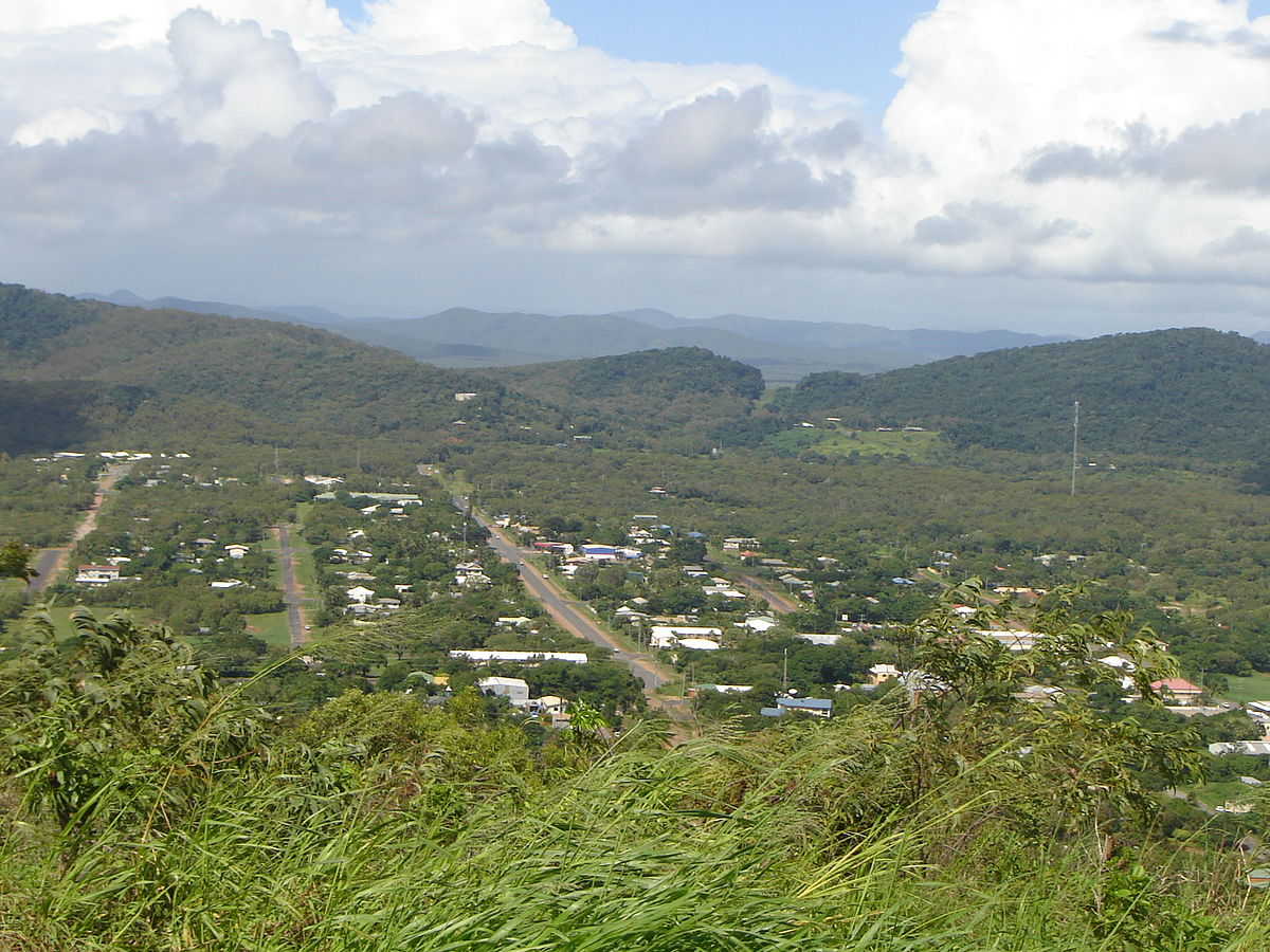
Cooktown_QLD_1_stitch_BCG.jpg
You can only see EXIF info for this image if you are logged in.


Road to the tip, some hundreds of kilometres like this, note corrugations and UHF aerial.
There is also another section to the right of the road that some people use as the actual road is so corrugated.
Cape_York_Road_1_BCG.jpg
You can only see EXIF info for this image if you are logged in.


Plaque at Cape York.
Cape_York_Plaque_1_BCG.jpg
You can only see EXIF info for this image if you are logged in.


Cape York, most northerly point on mainland Australia.
Cape_York_tip_of_OZ_stitch_BCG.jpg
You can only see EXIF info for this image if you are logged in.
 
@Yezdi , Thanks, really only indicative of what you see and drive through on during the whole trip, but worth the effort to get there and back.
The Cooktown shot is a stitch as is the tip with the 2 islands.
 
That road, it could be here! 😁
TFS, appreciate. We were sort of planned to go up to Cairns, and then Covid happend. Have already swotted up the bird places there.
Love the bottom image!
 
Nice. That road to the tip could also be any one of a number of areas in South Africa/Namibia where I grew up. Name it - north of Namibia, Northwest Province, etc.
In my experience there's only one way to drive such a corrugated road - maintain a speed of at least 100 km/h. That makes the car skim over the corrugations rather than rattling your fillings loose.
 
@Callie , we have no monopoly on such roads, but to get around Australia and into some/most/all(?) remote areas you will have to travel a lot of kilometres on them.

@Rassie, saw only one car doing that speed and the vehicle was pulled over by the Police soon after passing us, not sure why.
Must have been reported by radio, no phone reception outside of areas around the roadhouses.:D
Tyre pressures lowered to about 25 - 30PSI helps, but nothing really helps too much, such speed in such very dusty conditions is not something I was happy doing.
This is the sort of dust and vehicles that are on the roads that have to be dealt with, apologies phone camera though a very dirty window.
Found heading onto the up wind side of any road helps reduce the amount of dust in the vehicle.
There were at least 5 of these truck road trains traveling together, but about 2kms apart, they could be seen coming from over the horizon.

Trucks_0_BCG.jpg
You can only see EXIF info for this image if you are logged in.

Truck_Dust_1_BCG.jpg
You can only see EXIF info for this image if you are logged in.

Truck_Dust_2_BCG.jpg
You can only see EXIF info for this image if you are logged in.


@gordon_g thanks for the comments about the panos, really not really good quality as they were all hand held.
 
There is an unwritten law when travelling on roads like this or very narrow "one lane" bitumen. "Might has right". In other words, if you see something bigger than your vehicle coming at you, get off the road as far as you safely can and preferably come to a stop. Especially those big road trains like in @soundbyte's image, they have 62 tyres pumping out loose rocks like bullets. Smashed windscreens, apart from being expensive to replace, would be no joy to drive with in conditions like this. It also helps to have CB/HF Radio and talk to these guys. Let them know you are giving way to them or if you want to overtake them when going the same way. Common Sense prevails.

@Rassie. I have driven thousand's upon thousand's of klms of these roads in a variety of vehicles from sedans, 4wd buses and large tour coaches and always found that somewhere around 80kph (50mph) was the best speed. What you are aiming for is the vehicle your driving needs to just skim the top of the ruts. Too slow or too fast, the wheels want to sink into the ruts. It's a very fine balance.
 
Cooktown, Queensland, from Grassy Hill.

Cape York, most northerly point on mainland Australia.
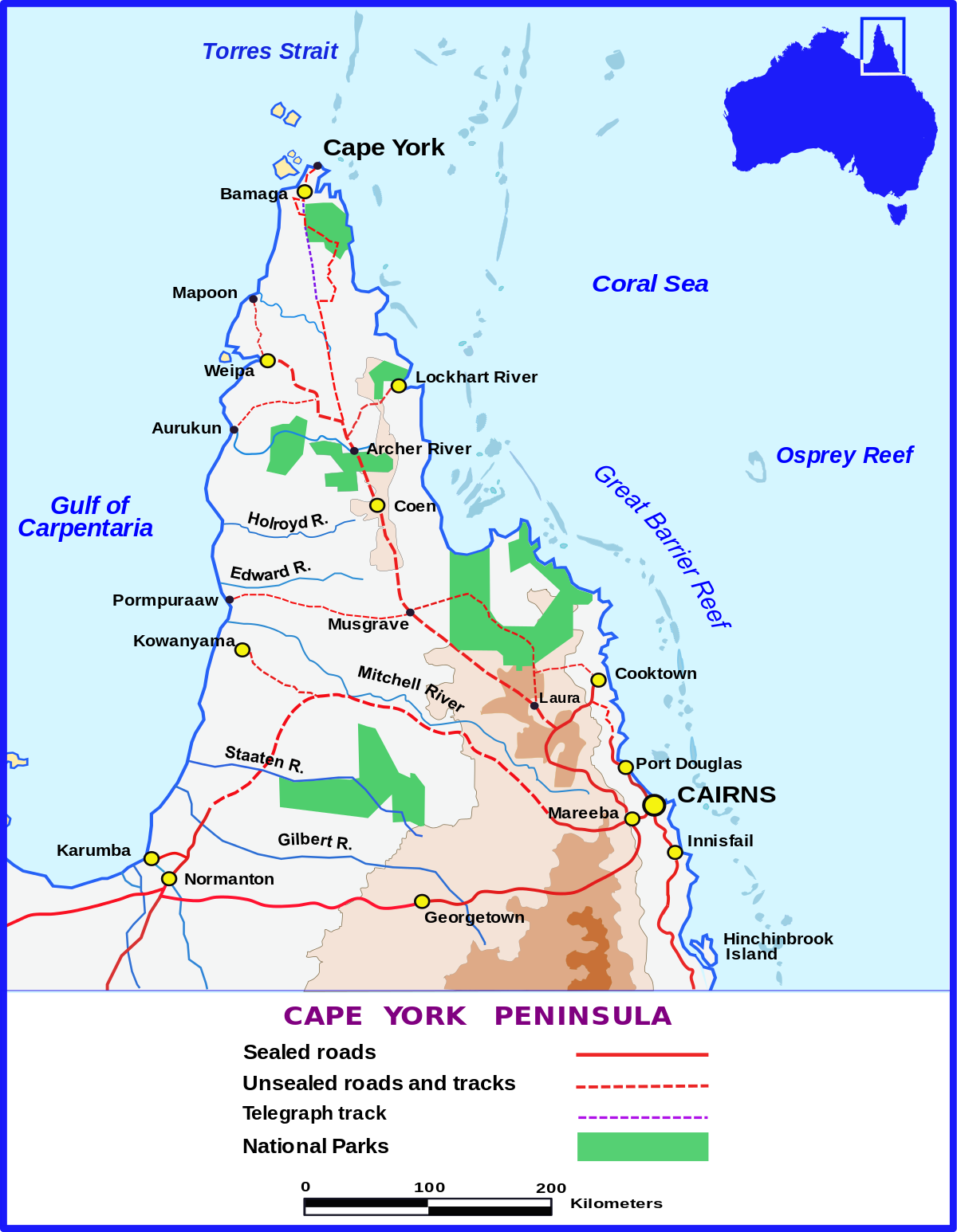
View attachment 9153

Really enjoyed these images Soundbyte and they have brought back a lot of memories. Below is a shot taken from the top of the island visible in your photo looking south back to where your shot was taken from. In 2019 we travelled by boat from Lockhart River to Thursday Island fishing and diving in some unforgettable locations.
Andy

untitled-20180425-IMG_08427.jpg
You can only see EXIF info for this image if you are logged in.
 
Man that is a lovely area, surely worth, maybe, flying up from Gold Coast and then driving around there!
Keep the landscapes coming and also some of the local birds! 😁
 
Awesome and now this and the Lake Eyre thread have just cranked up my Covid blues. Hopefully only a few more days and we can travel again. Yeeha Grandma
 
Back
Top